- What We Do
-
-
-
Speciality
-
-
-
- Off-the-shelf Data
-
- Solutions
- Platform
- Company
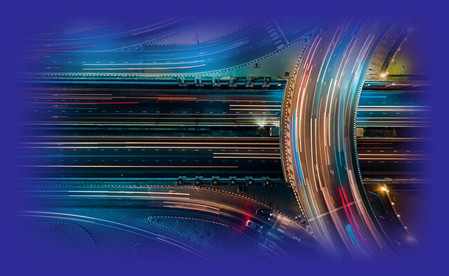


Satellite imagery plays a crucial role in sourcing quality and precise geospatial data for AI projects. Our impeccable network and airtight modus operandi ensure you get the most accurate, relevant, and updated training data for your training purposes for accurately training your AI model.
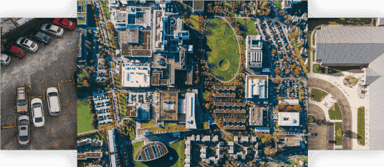
Geospatial data consists of several regular, irregular, and abnormal images and shapes. Annotating each element in datasets requires meticulous attention to detail and quality work hours. Our SMEs and data specialists go the extra mile in making sure every single pixel or byte of your data is annotated correctly.
Annotators plot points on each end or edge of an object, regardless of the shape or size in an image/video. In logistics, Geo.AI plugs the gap & gathers accurate location info that streamlines delivery.
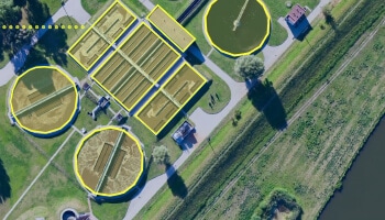
Detect instances of static or moving objects within a frame (image or video), to detect and tracking objects. Ride-sharing companies through Geo AI can calculate the density of cars & their availability in a particular area.

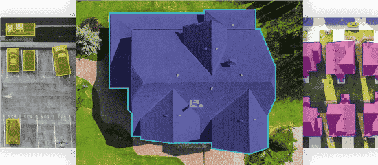
Points are placed on specific parts within an image by expert annotators to help locate, distinguish or identify the objects and view the image in totality
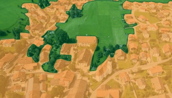
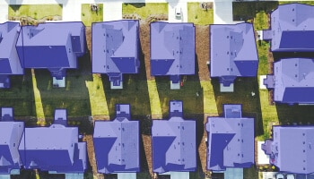
Images are clubbed/segmented accurately into different components and then labeled to detect objects within a given frame.
Extract information within the region under study. Intelligence that can be extracted are geolocation, seasonal & temporal variations, etc.
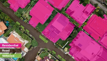
Classify objects in an image based on custom taxonomies, including land, road, vehicles, residential property, etc.

Dedicated and trained teams:

Highest process efficiency is assured with:

The patented platform offers benefits: